where Recovery Takes Root
How Healthy Rivers Bring Salmon Back
the recovery of
an endangered species
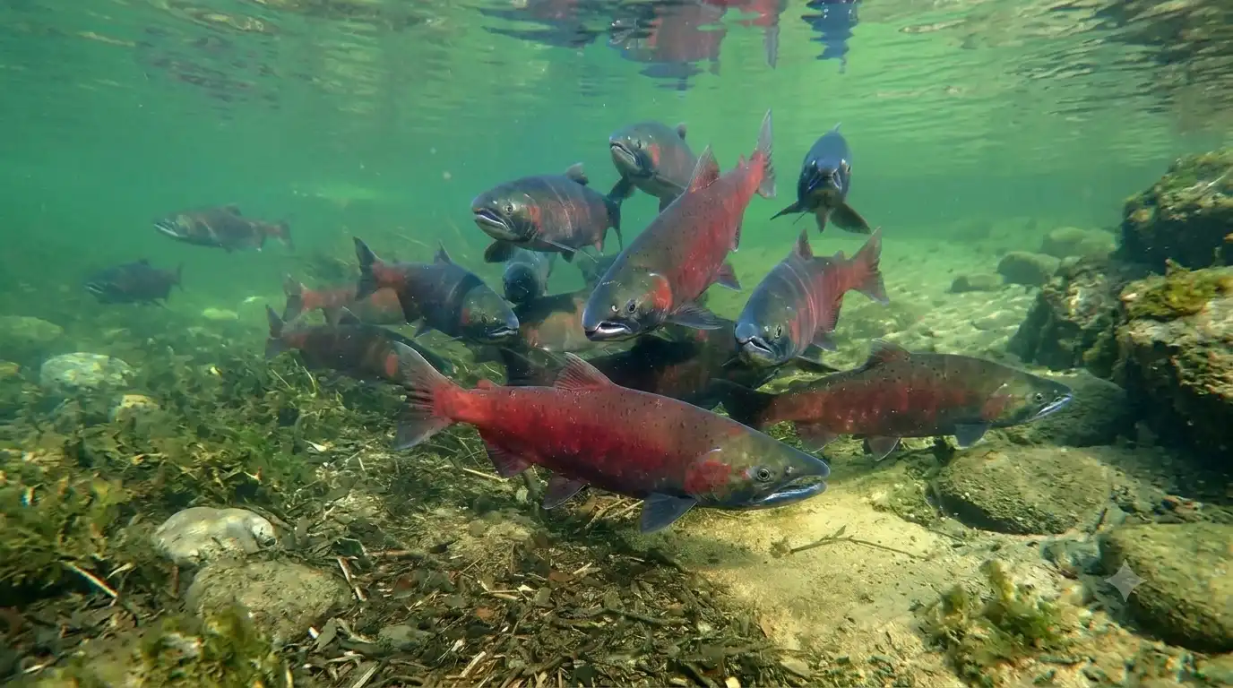
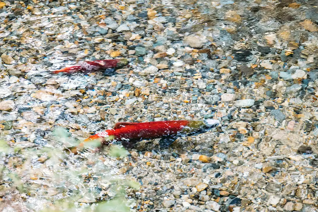
The salmon are returning. The clearest sign that the work is taking hold came in 2024. Coho salmon had been absent from Usal Creek for roughly a decade. Adult coho were observed by fish survey crews migrating up Usal Creek to spawn again, and juveniles were found using the newly created habitat. The South Fork Eel was once among the most productive salmon rivers in California. Three of the highest-priority watersheds for coho recovery sit within the Usal Forest.
10 years of absent
Trout Unlimited org confirmed coho hadn't been seen in Usal Creek since 2014, crediting the watershed's restoration work with reopening spawning access.
30,000 adult coho return
The 2024 return is part of a larger trend. In that season, Mendocino Coast rivers saw more than 30,000 adult coho return, over double the previous record
33 miles of stream habitat rebuilt
with engineered large wood structures, this create the deep, cool, complex pools salmon and steelhead need.
Usal Watershed geography
East to the River,
West to the Sea
water defines this forest
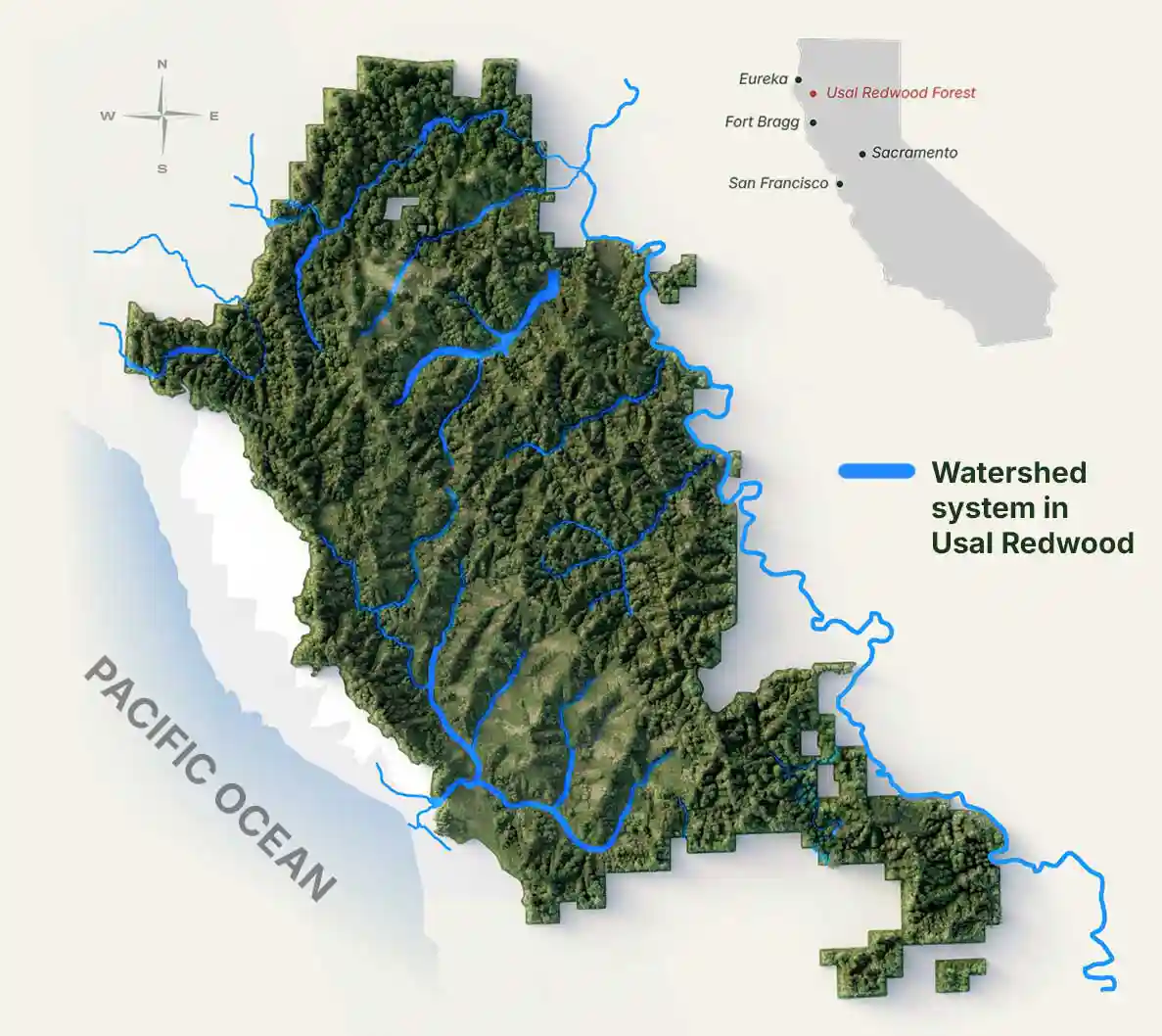
To the west, Usal Creek cuts through the land and reaches the Pacific at Usal Beach. To the east, a network of salmon-bearing streams drains into the South Fork Eel River, a wild and scenic river that traces the forest's eastern edge before eventually finding its way to the same ocean. Together, these two watersheds shape almost everything about how this land is managed.
On Usal Redwood Forest, we manage six watersheds with salmon runs, approximately 30,000 acres, that drain into the South Fork Eel River. The South Fork Eel River, Salmon Habitat Restoration Priority (SHaRP) watersheds, were identified by a collaboration of agencies and landowners as the most critical streams and watersheds to restore for Coho recovery.
Three of these watersheds are on Usal Redwood Forest, Indian Creek, Standley Creek and Hollow Tree Creek. Our restoration efforts in the last 15 years have focused on two of the three priority watersheds, Indian Creek and Standley Creek.
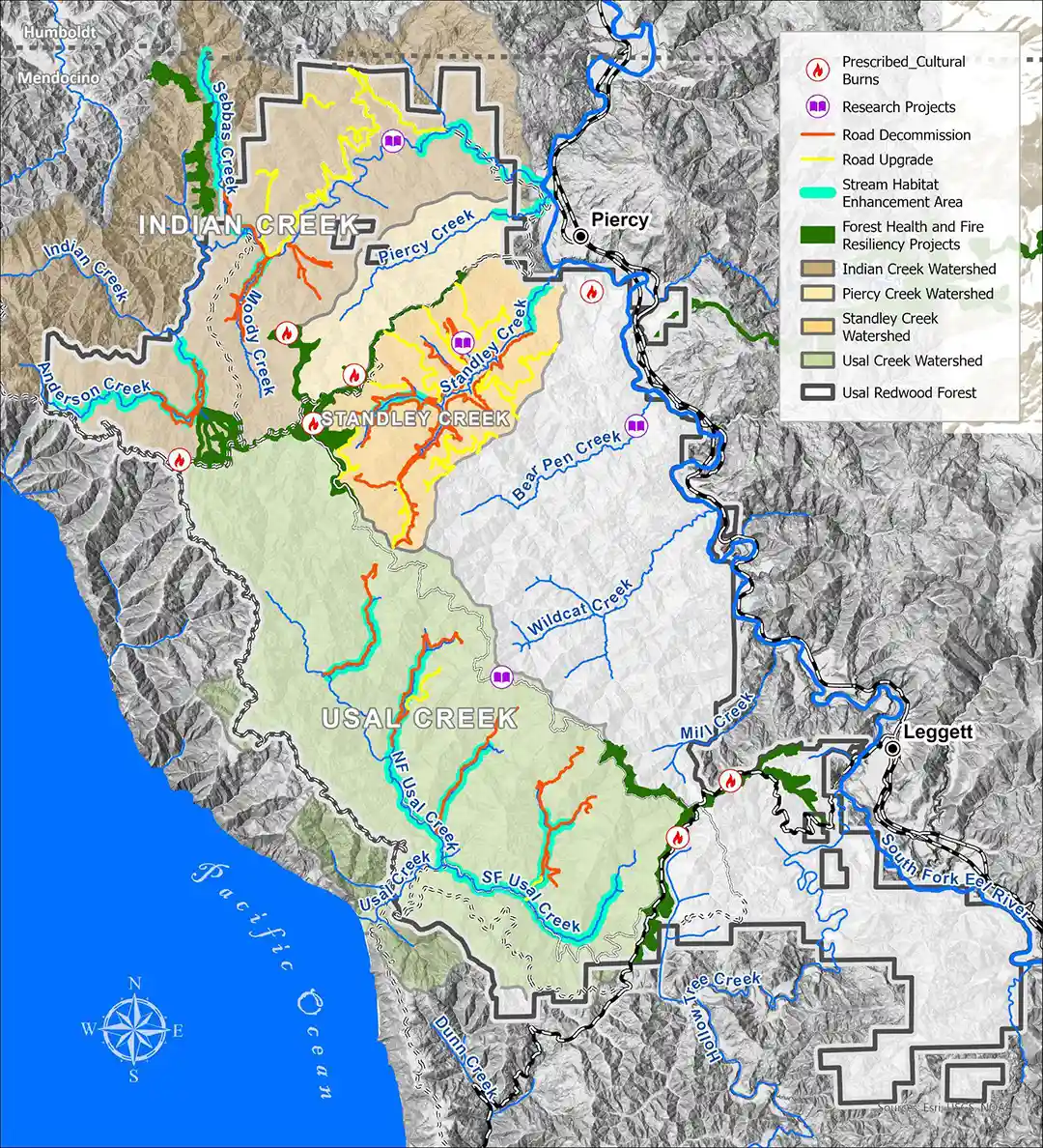
Usal Redwood Forest
Restoration Project
Map Overview
2008 - 2026
The Usal creek TO THE WEST
23,000 acres of coastal watersheds that supports coho and steelhead and is almost entirely on Usal Redwood Forest,flowing to the Pacific oceanjust one mile west of the forest boundary.
the South Fork Eel River to the east
30,000acres of salmon-bearing watershedsthat drain into the South Fork Eel River, a 105-mile National Wild and Scenic River that forms much of the forest's eastern edge.
The South Fork Eel was historically rich in salmon, chinook and coho, as well as steelhead. It is said that "the South Fork Eel River once supported about half of the total coho run for the State of California".
The watershed
problems & solutions
Roads, Rivers, and Fire. Restoring the Balance
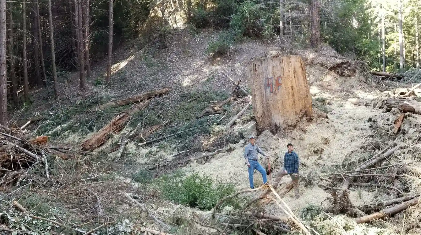
The problem
The Cost of
Industrial Logging
1. High-Density, Poorly-Placed Roads
Historic logging built transport routes directly in creek beds, riparian zones, and across steep slopes. This results to some of the highest road densities in the region.
2. Erosion and Degraded Fish Habitat
That road density caused major hillslope failures, continual erosion, and mass wasting that filled pools and destroyed prime salmon and steelhead habitat.
3. A Young, Overstocked, Fire-Prone Forest
Decades of intensive logging left behind dense, young stands with elevated wildfire risk across Usal and South Fork Eel watersheds.
THE SOLUTION
Three Ways of Restoring the Land
solution 01:
Reduce road density by decommissioning streamside legacy roads that also fix hillslope failures and prevent erosion.
9 miles
decommissioned and preventing 35,000 cubic yards (Usal Creek) of sediment from eroding into creeks.
39 miles
of legacy streamside roads decommissioned (forest-wide, since 2008)
31 miles
of failing roads upgraded & storm proofed
20 miles
decommissioned since 2008 (Standley Creek)
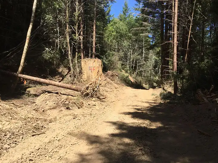
Before
Eroding streamside road before road decommissioning (Anderson Creek)
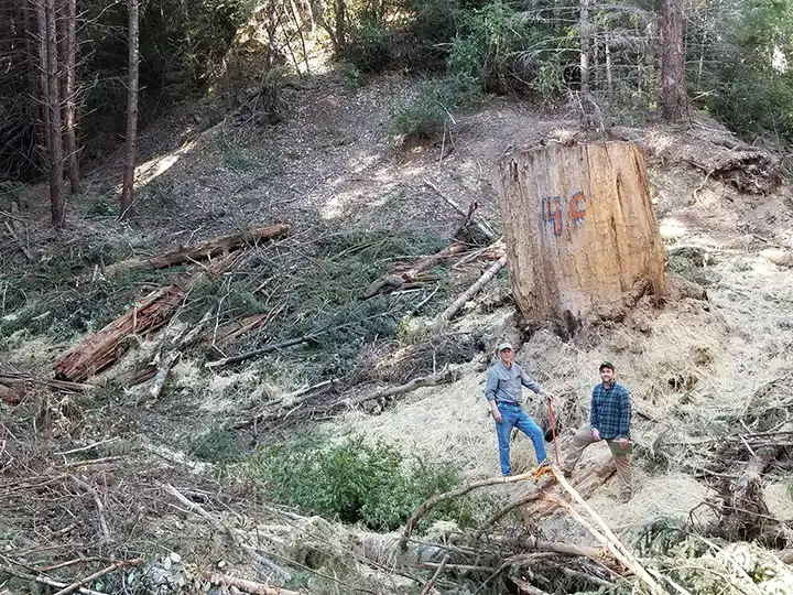
after
Streamside road after road decommissioning with hillslope drainage back in its natural channel and reconnected to the stream.
solution 02:
Augment stream habitat with large wood structures that create habitat complexity by reconnecting floodplains, creating deep pools, and shade structures for fish to hide under.
9 miles
of stream habitat enhanced with large wood (forest-wide, since 2012)
184
large wood structure installed across all six tributaries
142
more planned for South Fork Usal Creek in 2026
02 miles
of large wood structures installed for standley Creek
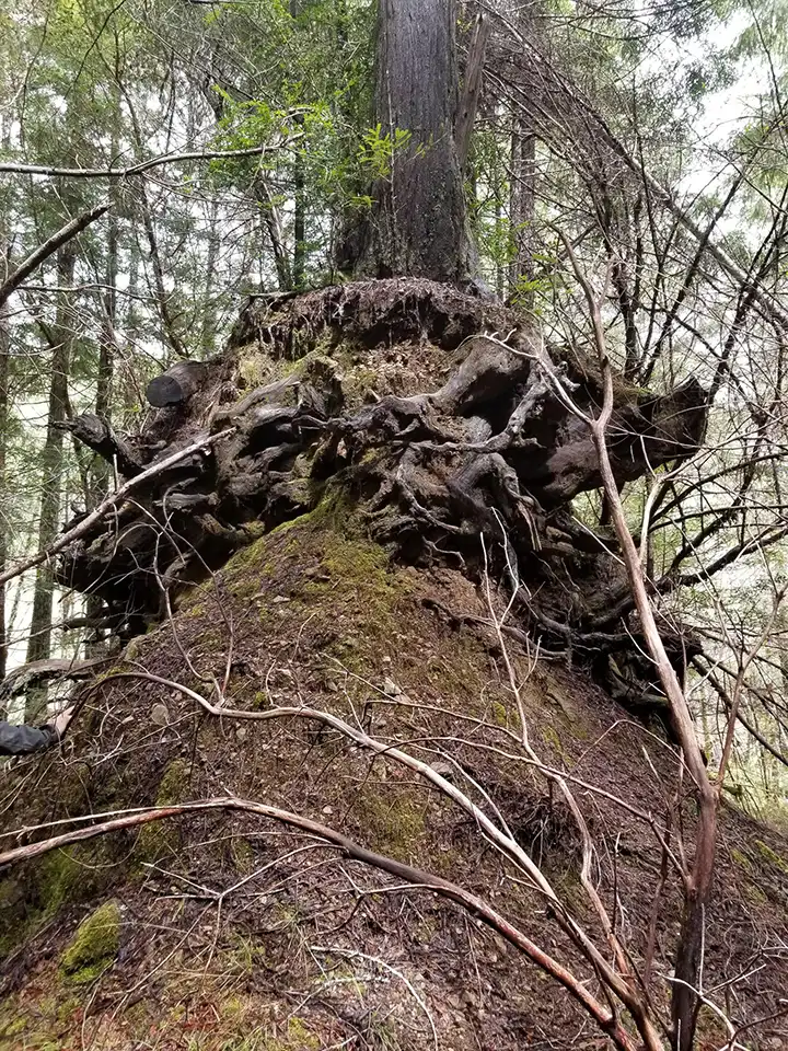
Before
Significant erosion on a legacy road along fish bearing Moody Creek
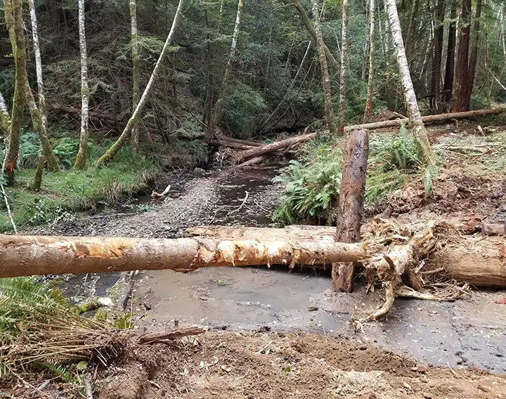
after
Large wood structure with beneficial rootwads that scour great pools during rainy season in Anderson Creek.
solution 03:
Ridgeline shaded fuel breaks reduce hazardous fuels while maintaining canopy to provide shade and limit understory regrowth. Thinning dense stands and removing ladder fuels also create firefighter access points and reduce fire intensity along prominent ridgelines.
1,298 Arces
of watershed resiliency/forest health work (forest-wide, since 2015)
07 ridgeline miles
of large wood structures installed for standley Creek
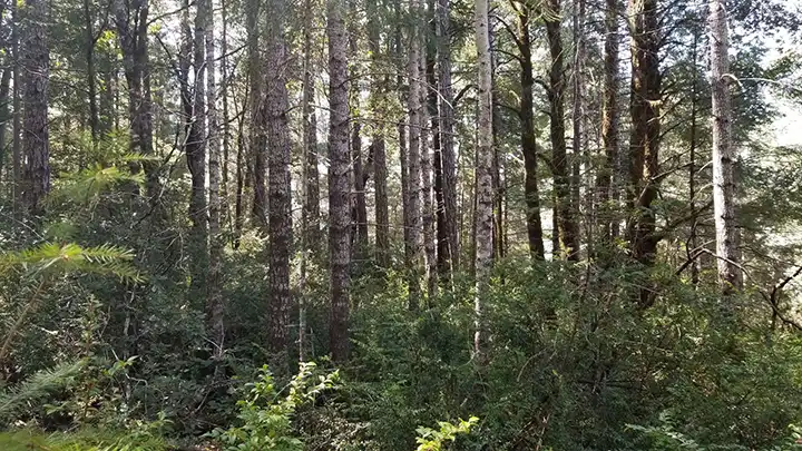
Before
Dense, young, fire prone forest.
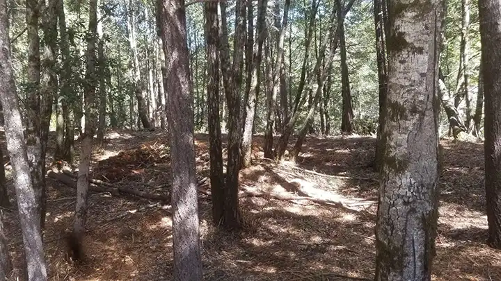
after
Removal of ladder fuels and thinning of dense stands will both provide anchor points for fire fighters to access watersheds
The next restoration priorities
portfolio of planned restoration projects
OUR vision and commitment is significant
As restoration at a watershed scale takes decades. Our mission and ownership of the forest in perpetuity is what allows this kind of long-horizon recovery. RFF maintains an informal ten-year portfolio of planned restoration projects. Immediate priorities include:
5000 acre priority watershed
for coho recovery almost entirely within the forest. RFF completed a comprehensive, watershed-scale restoration action plan for Standley Creek in 2026 and has five shovel-ready projects designed and awaiting implementation funding
20 miles of failing roads
already decommissioned and five years of stream-flow monitoring.
142 large wood structures
South Fork Usal Creek, where a 2026 project will add 142 large wood structures to extend habitat gains across the watershed.
A growing network
of ridgeline shaded fuel breaks, already spanning seven miles in the Usal watershed, that shield restored streams and habitat from high-intensity wildfire.